Pacific Rim National Park Reserve: A Visitor'S Guide
Most visitors meet this park as a parking lot with a pass machine on the way to a beach. It is a great deal larger and stranger than that: three separate pieces of coast, only one of which you can drive to, two of which shut for half the year. Here is how the whole thing is put together and what it costs to use.
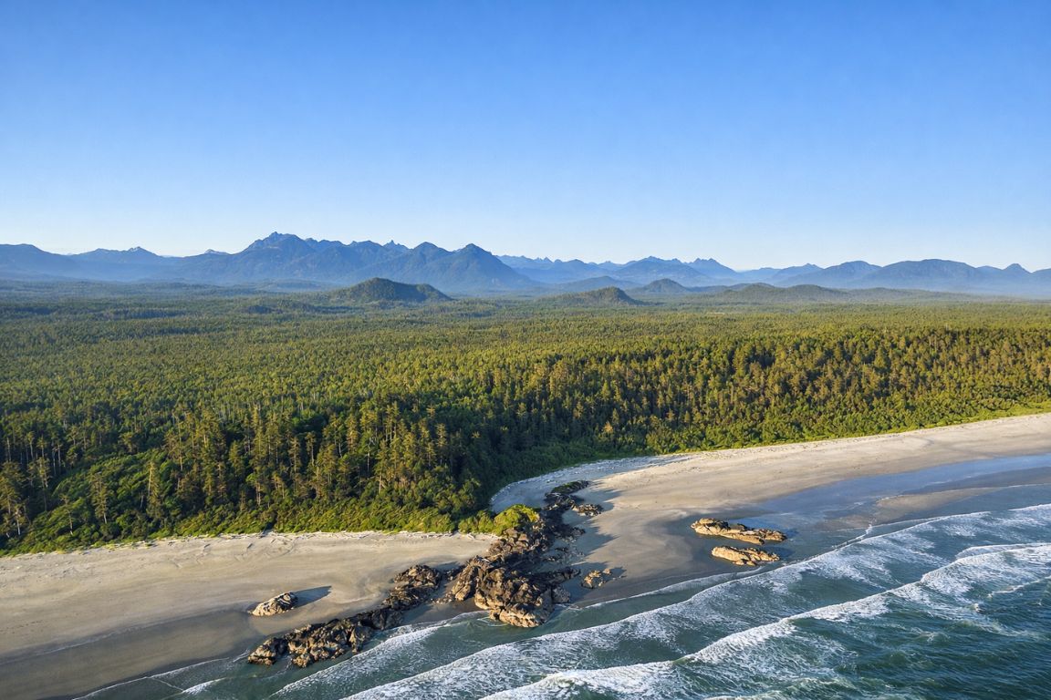
Ask ten people staying in Tofino what Pacific Rim National Park Reserve is and most will describe Long Beach. That is one third of the park, and the only third with a highway running through it. The other two pieces sit further south in Barkley Sound and along the outer coast toward Port Renfrew, reachable only by boat or on foot, open for five months of the year, and governed by a completely different set of rules.
This guide covers the park as a whole: the three units and what each is for, what a pass actually costs and when you need one, how to get in, what is open in which season, and the hazards and closures that catch people out. If you are looking for campground-by-campground detail, our dedicated guide to camping in Tofino and the park handles that; this page is about the structure the campgrounds sit inside.
The three units, side by side
Unit areas, opening seasons, permit conditions and fees are the currently published figures for Pacific Rim National Park Reserve. Fees are reviewed periodically, so check the park's own fees page before you travel.
Keep park access, transport and guided experiences separate. A day paddle from Ucluelet does not enter every park unit, and the longer guided itinerary starts in Vancouver.
Affiliate links: we may earn a commission from qualifying bookings.
What Is Pacific Rim National Park Reserve, And What Are Its Three Units?
Pacific Rim National Park Reserve is a 511 square kilometre federal reserve on the west coast of Vancouver Island, established in 1970. It comes in three separate, non-touching units: Long Beach, the West Coast Trail and the Broken Group Islands. Only Long Beach is open all year and reachable by road.
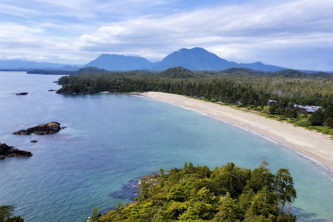
The word "reserve" in the name is not decorative. A national park reserve is land managed as a national park while Indigenous land claims remain unresolved, and seven First Nations hold traditional territory across this park. That legal status shapes a lot of what follows, from the naming of trails to who collects which fee.
The three units are genuinely separate places. Long Beach, the piece between Tofino and Ucluelet, is where the highway, the visitor centre, the drive-in campground and every beach lot are. The Broken Group Islands sit in Barkley Sound, an hour's drive south and then a boat ride offshore. The West Coast Trail runs down the outer coast between Bamfield and Port Renfrew, several hours away by road from either town. On the published figures for the reserve, Long Beach is 212 square kilometres, the West Coast Trail unit 193, and the Broken Group Islands 106. North of all of it, outside the park boundary, sits Clayoquot Sound, which is a separate designation again and the water most Tofino boat trips actually use.
| Unit | Size | Season | How you get in | What it is for |
|---|---|---|---|---|
| Long Beach Unit | 212 km2 | Year round | Highway 4, between Tofino and Ucluelet | Beaches, storm watching, rainforest boardwalks, cycling, the drive-in campground |
| West Coast Trail Unit | 193 km2 | May 1 to September 30 | Three trailheads: Pachena Bay, Gordon River and Nitinat Village | A 75 km multi-day backcountry hike with a permit and quota |
| Broken Group Islands Unit | 106 km2 | May 1 to September 30 for overnight use | Boat only, from Toquaht Bay or by scheduled water taxi | Sea kayaking, day paddling and backcountry island camping |
The practical consequence for anyone based in Tofino: unless you have specifically planned for it, your park visit is a Long Beach Unit visit. The other two units are trips of their own, and the Broken Group is the only one of them that a visitor with a normal holiday schedule can realistically reach on a day out from here.
What Does A Pacific Rim Park Pass Cost, And Do You Need One?
Parks Canada's current published daily rate is $12.25 for an adult, $10.75 for a senior, free for youth aged 17 and under, and $24.50 for a family or group. The annual Discovery Pass is $83.50 adult, $71.50 senior and $167.50 family. You need one to stop and use the park, not simply to drive through it.
Passes are sold at automated card-only kiosks in the parking lots and online, and the kiosks are checked. The rule that trips people up is the one about stopping: driving the highway between Tofino and Ucluelet without leaving the road does not require a pass, but pulling into any trailhead or beach lot does. Since almost every reason to be on that stretch of road involves stopping, most visitors need one.
The arithmetic on the annual pass is simple. At $83.50, an adult Discovery Pass breaks even against daily entry at roughly seven days of park use, and it covers every national park in the country for a year, so a longer Vancouver Island trip or a second national park visit tips it quickly. A family staying five nights and using the park most days is close to the line at $24.50 per day against $167.50.
| Pass | Current published price | Covers | Worth it when |
|---|---|---|---|
| Daily, adult | $12.25 | One adult, one day, all park day-use areas | One or two park days on a short trip |
| Daily, senior | $10.75 | One senior, one day | Same |
| Daily, youth 17 and under | Free | Youth entry | Always; do not buy a youth pass |
| Daily, family or group | $24.50 | Up to seven people arriving in one vehicle | Any group of three or more adults |
| Discovery Pass, adult | $83.50 | All national parks in Canada, one year | Seven or more park days, or a second park on the same trip |
| Discovery Pass, family or group | $167.50 | Same, for a household | A week or more of park days |
| West Coast Trail permit | $208.50 per person per trip | Backcountry use of the West Coast Trail | Separate from day entry; reserved months ahead |
One genuinely current wrinkle: the Canada Strong Pass has been running again this year, giving free admission and 25 per cent off camping and overnight stays with Parks Canada from 19 June to 7 September 2026. If you are reading this inside that window, you do not need a day pass at all. If you are planning for later, assume the standard rates above and check the park's own fees page before you travel, because these figures move.
What Is In The Long Beach Unit?
The Long Beach Unit holds everything most visitors picture: about sixteen kilometres of open sand at Long Beach itself, the Kwisitis Visitor Centre at Wickaninnish, six named day-use trails including two old-growth boardwalk loops, the Green Point Campground, and a 25 km paved pathway running the length of the unit.
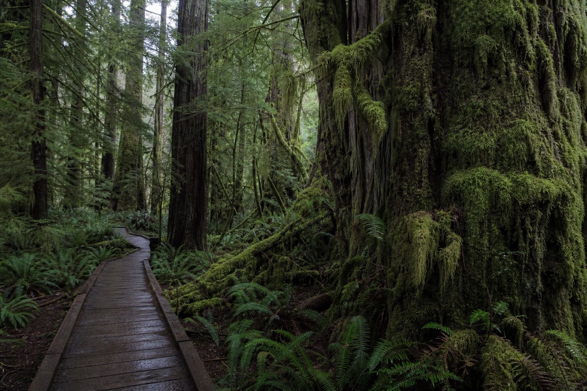
This is the part of the park you can use on a whim. The trails are short, signed and mostly boardwalked, which matters in a rainforest where the ground is wet more often than not. The Rainforest Trail's two 1.2 km loops walk through trees confirmed at over 1,400 years old and are the single best hour anyone spends in this park. South Beach, behind the Kwisitis Visitor Centre, trades forest for rock platforms and surf loud enough to feel. The Shorepine Bog Trail is under a kilometre, wheelchair accessible, and looks like nothing else on the coast: centuries-old shore pines that never got past a few metres because the bog gives them nothing to grow on.
| Long Beach Unit trail or site | Length | Grade | Why go |
|---|---|---|---|
| Rainforest Trail, loops A and B | Two 1.2 km loops | Easy boardwalk | Old growth confirmed at over 1,400 years; the best short walk in the park |
| South Beach Trail | 1.6 km out and back | Easy to moderate, stairs at the end | Rock platforms, tide pools, heavy surf; sneaker-wave warnings are serious |
| Nuu-chah-nulth Trail | 2.5 to 3.8 km one way | Moderate, uneven and muddy after rain | The longest boardwalk in the park, with Nuu-chah-nulth interpretation throughout |
| Shorepine Bog Trail | Under 1 km loop | Wheelchair accessible boardwalk | A bog ecosystem that looks like a miniature forest |
| Long Beach | About 16 km of sand | Flat | Surf schools, storm watching, the walk everyone comes for |
| Kwisitis Visitor Centre, Wickaninnish | Building | Accessible | Interpretation, washrooms, the park's best indoor hour on a wet day |
The Long Beach Unit is also where the park's weather personality shows. Winter storms here are an attraction rather than a problem, which is why so much of the local accommodation is built facing the water. Our page on the best time to visit Tofino goes month by month on that.
What Is The Broken Group Islands Unit, And How Do You Visit It?
The Broken Group Islands are over a hundred small islands and islets scattered across Barkley Sound, reachable only by boat. Overnight camping runs from 1 May to 30 September and is permitted only in designated areas on six islands. Most visitors arrive by guided day trip or scheduled water taxi rather than paddling in.
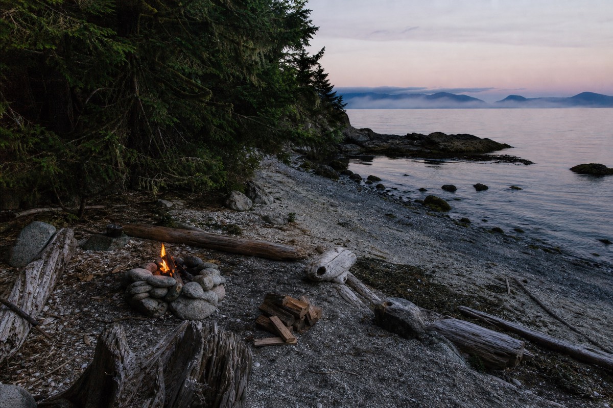
This is the most rewarding and least understood third of the park. The islands sit in sheltered water, which makes the paddling inside the archipelago far gentler than the open coast either side of it, and they carry deep cultural significance for the Tseshaht and Hupacasath First Nations, whose territory this is along with other Nuu-chah-nulth nations. Ancient fish traps, canoe runs and shell middens are still visible on the shorelines, and a guided trip is the difference between seeing a beach and understanding what you are standing on.
Getting there is the whole problem. Parks Canada is explicit that paddling out from Bamfield or Ucluelet is not recommended because of the exposed passages in between. The two sensible options are launching from the Toquaht Nation's Secret Beach Campground and Kayak Launch in Toquaht Bay, about an hour from either town on rough gravel road, or taking a scheduled boat that carries paddlers and their kayaks across.
| Question | Answer |
|---|---|
| How many islands | Over one hundred islands and islets across 106 km2 of Barkley Sound |
| Whose territory | Nuu-chah-nulth traditional territories; sites of cultural significance to the Tseshaht and Hupacasath |
| Where you can camp | Designated areas only, on Hand, Turret, Gibraltar, Dodd, Clarke and Gilbert Islands |
| Overnight season | 1 May to 30 September |
| Land launch | Toquaht Nation's Secret Beach Campground and Kayak Launch, Toquaht Bay, about an hour on gravel road |
| Water access | Scheduled paddler transport and licensed commercial operators |
| What Parks Canada advises against | Paddling across from Bamfield or Ucluelet, because of exposed passages |
For a visitor with one free day and no expedition kit, the guided day tour is the realistic route in. The eight-hour trip run by Hello Nature Adventure Tours out of the Ucluelet Small Craft Harbour includes the round-trip water taxi, the kayak gear, an interpretive guide and a catered lunch on a beach, leaves the dock at 8:00 am and is back around 4:00 pm, and carries a perfect rating across 359 bookings at $480. It is the most expensive single-day product we list and it is also the only one that gets an ordinary visitor into this unit properly.
What Is The West Coast Trail Unit, And Should You Attempt It?
The West Coast Trail is a 75 kilometre backcountry route along the outer coast between Bamfield and Port Renfrew, open 1 May to 30 September. It needs a reserved permit at $208.50 per person, an orientation session, and a group of no more than ten. It is not a day-visit option from Tofino and should not be treated as one.
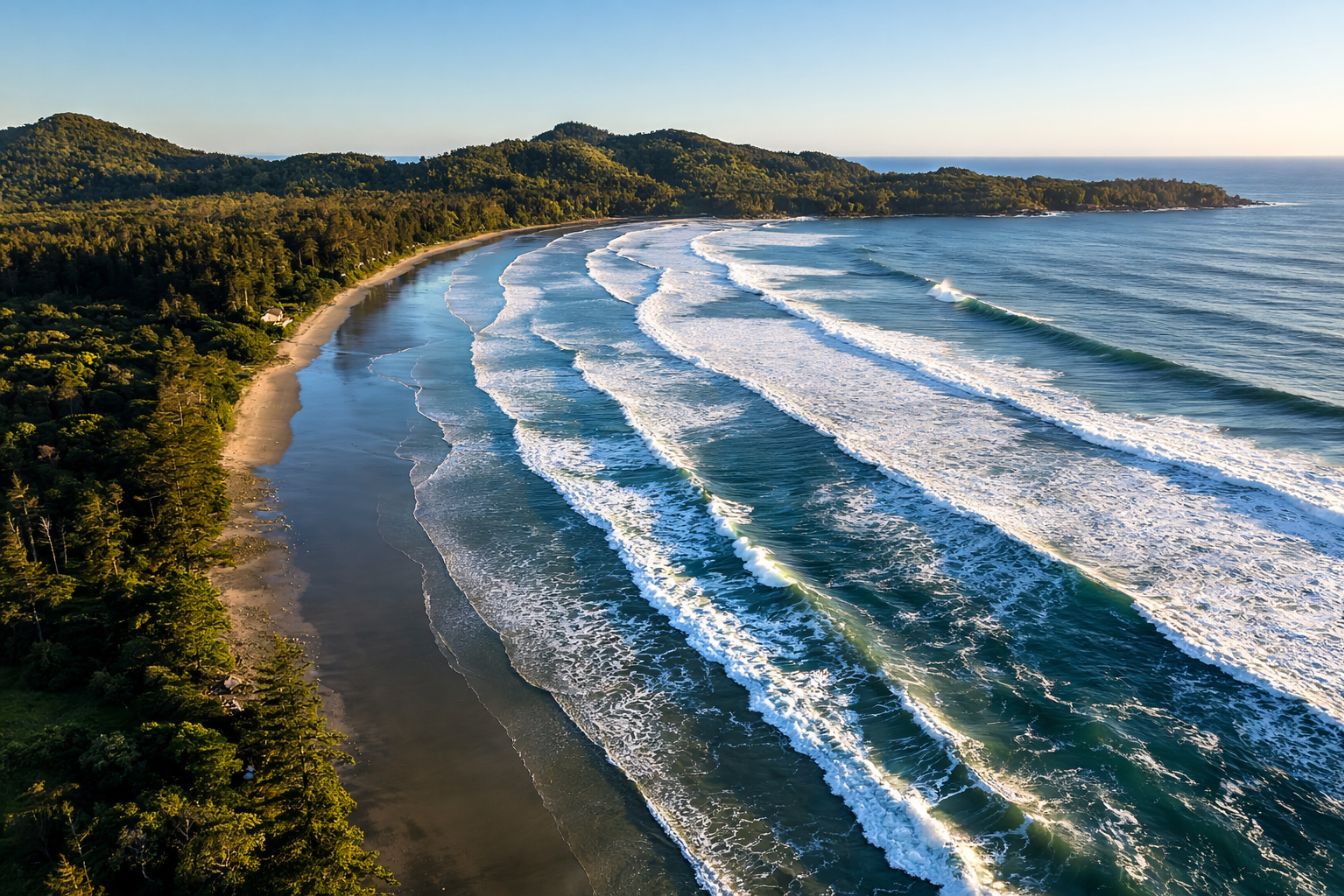
Everything about this unit is different from the beaches most readers of this page will use. The trail runs through old-growth forest, along wide beaches and across suspension bridges over rivers and streams, and it takes most parties the better part of a week. Reservations for the 2026 season opened at 8:00 am Pacific on 5 February 2026 through the Parks Canada reservation service, which is the pattern every year: a single opening morning, and the good departure dates gone quickly.
Three trailheads serve it. Pachena Bay near Bamfield and Gordon River at Port Renfrew are the two ends; Nitinat Village sits in the middle and is used for shorter itineraries. All three are reached by gravel logging road, bus or passenger ferry, and none of them are near Tofino. Realistically, a West Coast Trail trip is a separate holiday that happens to be inside the same park boundary as your beach week. The nearest thing to it that fits inside a Tofino stay is the Lone Cone climb on Meares Island, which our Tofino hiking trails guide covers.
How Do You Get To Pacific Rim National Park?
The Long Beach Unit is reached on Highway 4, the road that crosses Vancouver Island from Port Alberni. That last stretch is 108 kilometres of steep, winding two-lane road and takes at least ninety minutes. From Vancouver, add a BC Ferries crossing and count on five to six hours door to door.
The single most common planning error is underestimating that final highway. It is not a motorway with a scenic name. It climbs, it twists, it has slow-vehicle sections and it closes occasionally for slides or maintenance, and the drive times below assume nothing goes wrong. Building an hour of slack into arrival day is the cheapest insurance available.
| From | Time to the Long Beach Unit | Notes |
|---|---|---|
| Port Alberni | About 2 hours | 108 km of steep, winding Highway 4; last fuel and full groceries before the coast |
| Parksville | About 2.5 hours | Where the island highway hands over to Highway 4 |
| Nanaimo | About 3.5 hours | The ferry town for the Vancouver crossings |
| Victoria | About 5 hours | A full driving day; do not pair it with an activity booking |
| Vancouver | 5 to 6 hours including the ferry | Horseshoe Bay to Departure Bay now requires advance vehicle booking |
| By air | About 45 min floatplane, about 1 hour scheduled | Scheduled flights land at Tofino/Long Beach Airport, roughly 16 km from town |
Without a car the park is harder but not impossible. The bus reaches Tofino, and shuttle and tour operators cover the main beaches and trailheads. Our guide to Tofino without a car sets out what is genuinely reachable and what is not.
Can You Cycle The Park On The Multi-Use Pathway?
Yes, and it is the most underrated thing in the Long Beach Unit. ʔapsčiik t̓ašii is a 25 kilometre paved pathway running the length of the unit, linking the Tofino and Ucluelet multi-use paths at either end. The name translates as going in the right direction on the path.
The pathway was built through the traditional territories of the Tla-o-qui-aht First Nation and the Yuułuʔiłʔatḥ, and the naming reflects that partnership rather than decorating it. What it does practically is remove the car from a park visit. You can ride from town to a trailhead, walk a boardwalk loop, ride on to a beach, and never queue for a parking space in August. For families it turns the middle of the day into an activity rather than a transfer.
Bike rental is available in both towns, and the guided version exists too: the three-hour bike and hike out of 390 Main Street in Tofino puts you on a beach cruiser with a guide and a walk to Penniger Point at the end, at $118 with a 4.8 rating from 284 bookings, capped at ten people. On a summer day when the lots are full by ten, arriving anywhere by bicycle stops being the eccentric option.
Where Can You Camp Inside The Park?
Green Point Campground in the Long Beach Unit is the only drive-in campground inside the park, and it books out well ahead. Backcountry camping in the Broken Group Islands is allowed from 1 May to 30 September in designated areas on six named islands. Everything else nearby is private or provincial.
Parks Canada's fee schedule lists Long Beach camping at $34.00 per night unserviced and $40.00 with electricity, reserved through the Parks Canada reservation service or by phone. Those are the park's own sites; the private campgrounds along the beach corridor price very differently and fill on a different calendar, and the provincial options run through BC Parks on a separate reservation system again. Because the Canada Strong Pass window this year also carried 25 per cent off Parks Canada camping and overnight stays between 19 June and 7 September 2026, the arithmetic on a park site against a private one has been unusually favourable this season.
We have kept this section deliberately short because it is a whole subject of its own. Our guide to camping in Tofino and Pacific Rim compares the park sites against the private campgrounds and the provincial options, with booking windows for each.
When Should You Visit, And What Is Open When?
The Long Beach Unit is open every day of the year and changes character completely between seasons. The other two units are open 1 May to 30 September only. Summer gives warmth, long days, full car parks and marine fog; winter gives storms, empty trails and the lowest accommodation rates of the year.
Season planning here is less about weather quality than about what you want the weather to do. Storm watching between November and February is a legitimate reason to travel, and half the coastal accommodation is designed around it. Gray whales pass on their northern migration through March and April. Summer is peak everything, including the fog that locals nickname "Fogust," which some years sits over the coast for weeks. September threads the needle: warm water, first swells, thinning crowds and everything still running.
| Season | Long Beach Unit | Broken Group Islands | West Coast Trail |
|---|---|---|---|
| January to April | Open; storm watching, then the gray whale migration in March and April | Closed to overnight use | Closed |
| May | Open; quiet, everything reopening | Overnight season opens 1 May | Season opens 1 May |
| June to August | Open; peak crowds, lots full by mid-morning, fog possible | Peak paddling season, book ahead | Peak hiking season, permits long gone |
| September | Open; the best all-round month | Overnight season ends 30 September | Season ends 30 September |
| October to December | Open; storms build, rates drop, trails empty | Closed to overnight use | Closed |
One practical detail for shoulder-season visitors: the Long Beach Unit staying open does not mean every service inside it does. Interpretation programmes, the visitor centre hours and campground operations all run on seasonal schedules, so check the park's own hours page rather than assuming.
What Rules, Hazards And Closures Should You Know?
Four things catch people out here: sneaker waves on rock platforms, tides that cut off beach access, wolf-related closures with dog prohibitions attached, and summer fire bans. All four are posted, and all four are ignored regularly enough that Parks Canada keeps posting them.
The wave hazard is the serious one. South Beach and the rock platforms along this coast produce surge and sneaker waves that arrive without a build-up, and the warning signs at the top of the stairs are not boilerplate. Stay back from wet rock, and treat any ledge with a dark, water-polished surface as a place a wave has recently reached. Tides matter for the same reason: beach sections that are a pleasant walk at low water become a scramble or a trap at high, so check the tide table before any trail that ends on sand.
| Hazard or rule | What it means in practice |
|---|---|
| Sneaker waves and surge | Stay off wet rock and back from ledges, especially at South Beach; waves arrive without warning |
| Tides | Check a tide table before any trail ending on a beach; some access floods at high water |
| Wolves | Wolf-related closures and dog prohibitions are posted from time to time and are enforced |
| Dogs | Restricted in parts of the park; leashed where allowed; check the current dog rules before you arrive |
| Fire bans | Summer bans are common on this coast and one has been in force through the 2026 season; check advisories before planning a beach fire |
| Wet boardwalk | Moss on cedar planks is the most common cause of injury; grip-soled shoes, not smooth soles |
| Cell coverage | Unreliable inside the forest; download maps before you leave town |
| Pass checks | Kiosks are card-only and are checked; buy before you walk away from the car |
Advisories change through the season. Parks Canada posts current closures, fire bans and wildlife notices on the park's own site, and that page is the only version of this information worth trusting on the morning you set out.
How Should You Plan A First Visit To Pacific Rim National Park?
Buy a day pass or a Discovery Pass depending on how many park days you have. Spend the first one in the Long Beach Unit doing the Rainforest Trail, Long Beach and South Beach. Give a separate full day to the Broken Group Islands if you want the second unit. Treat the West Coast Trail as a different holiday.
A workable first day looks like this. Arrive at the Rainforest Trail early, walk both loops in under two hours, drive to Long Beach and walk the sand, eat at Kwisitis or in the car, then take the South Beach Trail down to the rock platforms in the afternoon when the tide is falling. That is one pass, one parking fee, and a fair cross-section of what the unit does. Add the Shorepine Bog Trail if you have an hour spare and want to see something genuinely odd.
The second unit needs its own day and a booking, because there is no way to reach the Broken Group Islands casually. Beyond the park boundary, the water either side of it is where most of the wildlife actually is: the private four-and-a-half-hour boat trip from Tofino that drops crab traps in Tofino Inlet and walks the Big Tree Trail on Meares Island is a good example of a day that uses the coast without ever needing a park pass at all, and it has taken 308 bookings at a 4.7 rating.
Everything above is public land you can walk into on a day pass and a full tank. When you want the boat-based half of this coast handled by people who already hold the licences and the vessels, that is what the operators listed at Tofino Tour Packages are for, and it is worth booking those before you fix the rest of the week around them.