Clayoquot Sound: A Visitor'S Guide To The Biosphere
Everything you can see from the Tofino waterfront is Clayoquot Sound, and almost nobody who stays here could tell you where it starts, who it belongs to, or what the UNESCO label on the tour listings actually means. It has no gate, no ticket and no road. This is how the place is put together and how you get into it.
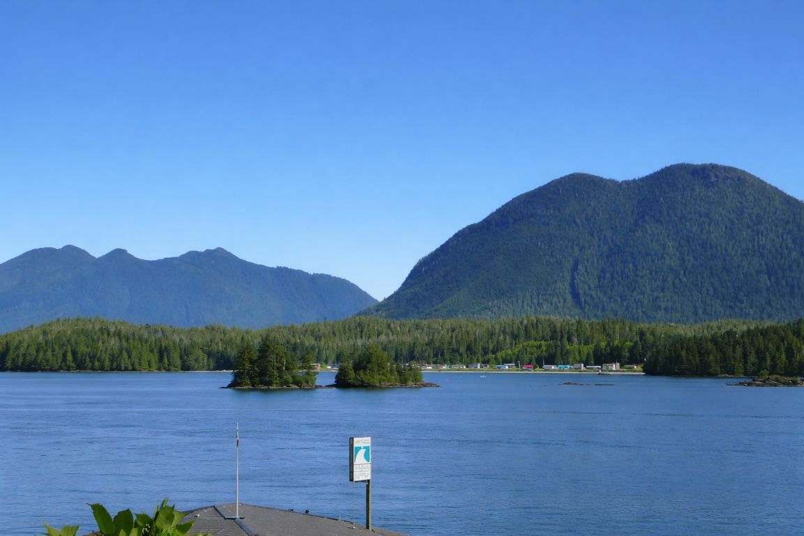
The name is on half the tour listings in town and on none of the road signs. Visitors arrive, take a boat somewhere, come back, and never quite work out whether they went to Clayoquot Sound or somewhere else. That is understandable: it is not a park, not a town and not a protected area in the way people expect. It is a large piece of coastline with an international designation over it, several nations' territory inside it, and a history that shaped Canadian environmental law.
Our site has sold trips into this water for years without ever explaining it. This guide fixes that. What follows is the geography, the designation, the territory, the 1993 history, and the practical part: the actual ways a visitor with a few days in Tofino can get out onto the Sound and what each one gives you.
Four dates that made Clayoquot Sound
The 1984 Meares Island blockade, the 1993 arrests, the 2000 UNESCO designation and the 2025 renaming of the park at Hot Springs Cove are all matters of public record. The area figure is the published extent of the Biosphere Region.
Choose how you want to enter the Sound: paddle with a guide, take a wildlife boat, or commit a day to the springs. These are different routes and time commitments.
Affiliate links: we may earn a commission from qualifying bookings.
What And Where Is Clayoquot Sound?
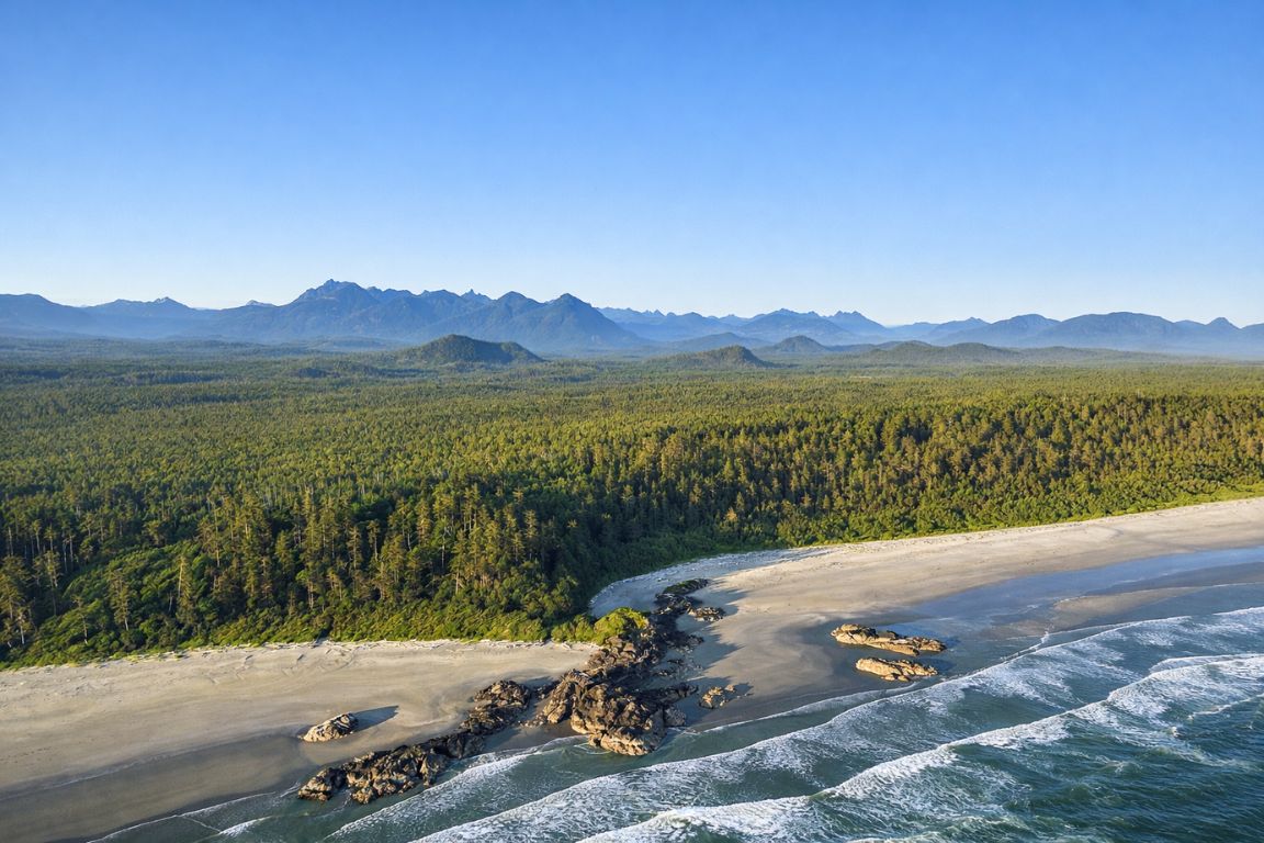
Clayoquot Sound is a large system of inlets, islands and old-growth rainforest on the west coast of Vancouver Island, wrapping north and west from Tofino. It covers roughly 350,000 hectares of land and water, holds the largest area of unlogged temperate rainforest left on the island, and has been a UNESCO Biosphere Reserve since 2000.
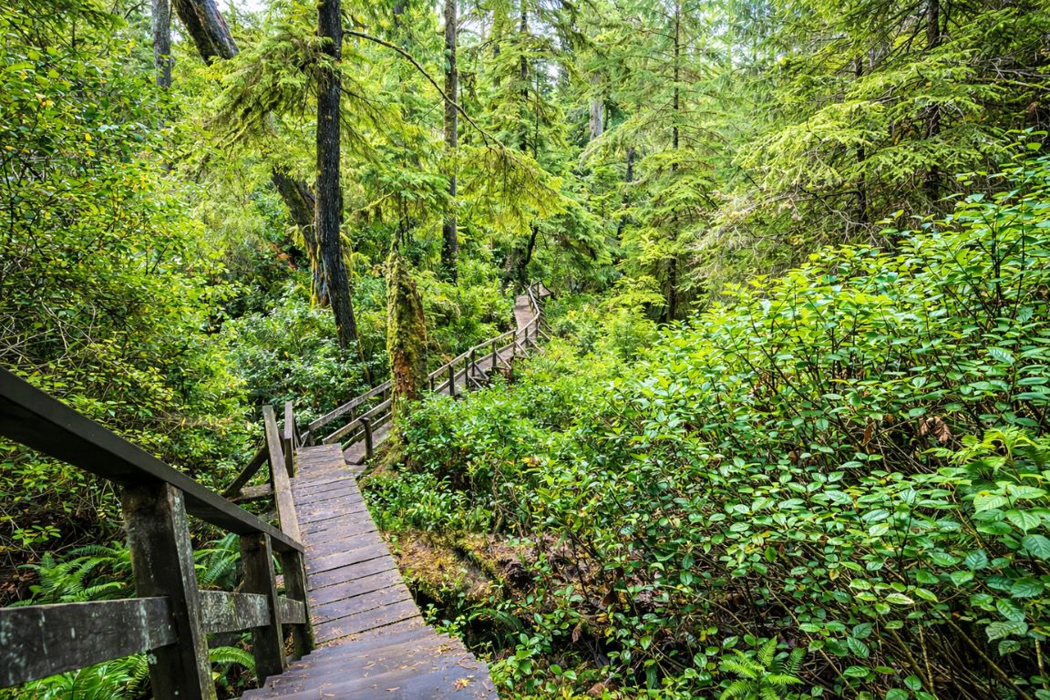
Geographically it is a drowned coastline: long fjord-like inlets reaching inland, a scatter of big forested islands across the mouth, and open Pacific beyond. The main islands are Meares, Vargas and Flores. The main inlets are Tofino, Lemmens, Bedwell, Herbert, Shelter and Sydney. The communities inside it are Tofino itself and Opitsaht, the Tla-o-qui-aht village on Meares Island directly across the harbour from the town dock.
The key thing to hold onto is that Tofino sits at the southern edge of it. When you stand on the town waterfront looking at the forested hump of Meares Island, you are looking at Clayoquot Sound. Everything a water taxi, a kayak or a floatplane does out of Tofino harbour, apart from trips south along the surf coast, happens inside it.
| Detail | Figure |
|---|---|
| Designated a UNESCO Biosphere Reserve | 2000 |
| Approximate area | About 350,000 hectares, roughly 860,000 acres, of land and water |
| Main islands | Meares (Wanachus-Hilthuuis), Vargas, Flores |
| Main inlets | Tofino, Lemmens, Bedwell, Herbert, Shelter, Sydney |
| Communities inside it | Tofino and Opitsaht, on Meares Island |
| Forest status | The largest area of intact, unlogged temperate rainforest remaining on Vancouver Island |
| Road access | None beyond Tofino itself; everything else is water or air |
That last row is the one that determines your whole trip. There is no scenic drive around Clayoquot Sound. The highway ends in Tofino and the Sound begins where the pavement stops.
How Do You Pronounce Clayoquot, And What Does The Name Mean?
It is said roughly as KLA-kwot, with a flat first syllable and no hard "oy" sound. The spelling is a nineteenth-century rendering of a Nuu-chah-nulth name. It comes from a group who lived at a place recorded as Clayoqua and who later merged into the Tla-o-qui-aht, whose own name means different, or changing.
Visitors reliably get this wrong, usually as "clay-oh-kwot" or "clay-oh-kwat," and locals are relaxed about it. Getting closer is worth the effort anyway, because the pronunciation is the first small signal that you understand the name belongs to someone. The modern spelling of the nation, Tla-o-qui-aht, and the older spelling of the Sound, Clayoquot, are two attempts at writing the same root in English.
The meaning is a nice piece of history in itself. Tla-o-qui-aht is usually translated as "different" or "changing people," a name that describes a group whose composition and territory shifted over time. Names on this coast tend to be descriptive rather than commemorative, which is also why the provincial park at Hot Springs Cove was renamed in 2025: the Nuu-chah-nulth tradition avoids naming a place after a chief.
What Does UNESCO Biosphere Status Actually Mean Here?
Less than most visitors assume and more than the sceptics claim. It is not a national park designation and it does not ban logging or development. It is a recognition of biological and cultural value that came with a fund and a governance body, meant to support research, education and a working relationship between conservation and the people who live here.
Clayoquot Sound was designated in 2000, and the designation arrived with a $12 million fund for research, education and training. That money became the Clayoquot Biosphere Trust, which is unusual in being both a community foundation and a UNESCO biosphere organisation at the same time, a combination that does not exist anywhere else in Canada. Its own site is the best current source on how the region is governed and who sits inside it.
Biosphere regions are structured in three zones: core areas protected for biodiversity and research, buffer zones where compatible activity happens, and transition areas where communities live and work. In practice, in Clayoquot Sound those zones overlap with a patchwork of other designations, including part of Pacific Rim National Park Reserve, provincial parks and the Tla-o-qui-aht Tribal Parks. The Trust notes on its own site that its published zoning maps date from 2021 and are being revised, following the ʕaaḥuusʔatḥ (Ahousaht) Nation's announcement in August 2025 that it was stepping back from the Trust.
| What people assume | What is actually true |
|---|---|
| It is a national park | It is not. Part of Pacific Rim National Park Reserve sits nearby, but the Biosphere Region is a separate designation over a much larger area |
| Logging is banned | No. The designation recognises value and funds research; land-use decisions sit with governments and nations |
| You need a permit to enter | No. There is no gate, no ticket and no entry fee to the Sound itself |
| It came with nothing | It came with a $12 million fund, now the Clayoquot Biosphere Trust |
| It is one uniform protected area | It is zoned into core, buffer and transition areas that overlap other designations |
| The boundaries are settled | Zoning maps are being revised after a member nation stepped back from the Trust in 2025 |
The useful takeaway for a visitor is that the designation tells you what kind of place this is, not what you are allowed to do in it. The rules that actually govern your day come from Parks Canada, BC Parks, or the nation whose territory you are on.
Whose Territory Is Clayoquot Sound?
It is Nuu-chah-nulth territory, held by several nations. Hesquiaht territory covers the north, Ahousaht the middle and Tla-o-qui-aht the south, including the water around Tofino. The Biosphere Region also takes in Yuułuʔiłʔatḥ and Toquaht territory to the south. These are living jurisdictions, not historical footnotes.
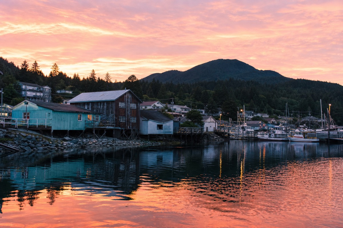
This matters practically as well as ethically. Several of the places visitors most want to reach are managed by the nation whose territory they sit in, and several carry their own fees collected on arrival rather than through any government. The Big Tree Trail on Meares Island is run by the Tla-o-qui-aht as part of a tribal park, with a trail fee paid at the landing. Hot Springs Cove is stewarded by the Ahousaht through the Maaqutusiis Hahoulthee Stewardship Society, with guardians present at the entrance in the core season.
The Tla-o-qui-aht Tribal Parks are the piece of this most worth understanding, because they began the modern story. The first was declared over Meares Island in 1984, in direct response to logging plans, and three more followed: Ha'uukmin in the Kennedy Lake watershed, Tranquil and Esowista. They are a working assertion of jurisdiction rather than a heritage label, and the trail fees you pay fund the guardians who maintain them.
| Nation | Where in the Sound | What a visitor is most likely to encounter |
|---|---|---|
| ƛaʔuukʷiʔatḥ (Tla-o-qui-aht) | The southern Sound, including the water around Tofino | Meares Island and the Big Tree Trail, the Tribal Parks, the village of Opitsaht |
| ʕaaḥuusʔatḥ (Ahousaht) | The middle Sound, including Flores Island | Hot Springs Cove stewardship and guardians, the Wild Side of Flores Island |
| hiškʷiiʔatḥ (Hesquiaht) | The northern Sound and Hesquiat Peninsula | The far northern coastline beyond most day trips |
| Yuułuʔiłʔatḥ (Ucluelet First Nation) | South, within the Biosphere Region | The Ancient Cedars interpretive loop on the Wild Pacific Trail |
| tukʷaaʔatḥ (Toquaht) | South, Toquaht Bay | Secret Beach Campground and the kayak launch for the Broken Group Islands |
If you take one habit away from this section, make it this: when a fee is collected at a landing or a trailhead by someone in a guardian jacket, that is not an optional extra bolted onto your day. It is how the place is looked after.
What Happened In 1993, And Why Does It Still Shape The Sound?
In the summer of 1993, more than 800 people were arrested blockading logging roads in Clayoquot Sound, in what became the largest act of civil disobedience in Canadian history to that point. It followed the 1984 Meares Island blockade. Between them, those two events are why the forest you paddle past is still standing.
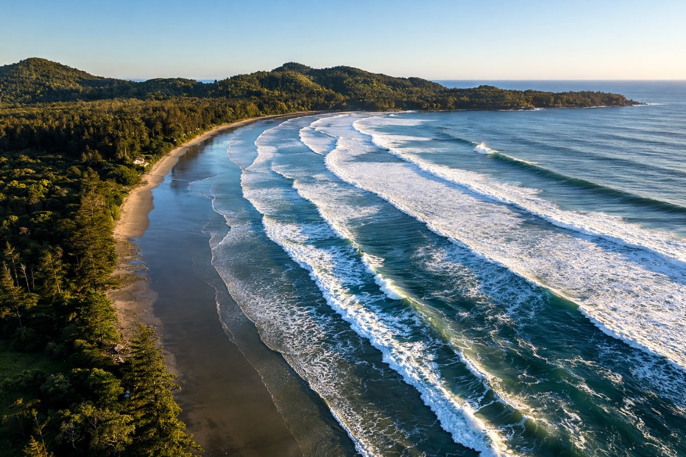
The 1984 action came first and was the more consequential of the two. The Tla-o-qui-aht and Tofino residents together blockaded planned logging on Meares Island and declared it a tribal park. The 1993 protests were larger and more widely reported, aimed at MacMillan Bloedel's permits, and drew First Nations members, environmental organisations and political figures into a summer of arrests on a logging road outside a town of a couple of thousand people.
What makes this more than a history lesson is that you can see the outcome from a kayak. The unbroken forest running down to the water on Meares Island, the old growth on the Big Tree Trail boardwalk, the intact valleys behind the inlets: none of that is accidental scenery. The UNESCO designation in 2000 came seven years after the arrests and is directly downstream of them, as are the Tribal Parks that now cover much of the southern Sound.
The story also has not ended. Land-use conflict, forestry, and the question of who decides remain live here, and the Trust's own governance shifted as recently as 2025. Visitors who arrive expecting a settled wilderness postcard are missing the more interesting thing, which is a working coastline where the arrangements are still being negotiated.
How Do You Actually Get Out Into Clayoquot Sound?
By water or by air, because there is no road. The realistic options from Tofino are a guided kayak trip with a boat transfer, a wildlife cruise, a water taxi to Meares Island, a full-day run to Hot Springs Cove, or a floatplane. Each one reaches a different distance into the Sound, and that distance is what you are really choosing between.
Think of it as concentric rings. The inner ring is the harbour and Meares Island, ten minutes out, cheap and doable on a whim. The middle ring is the inlets behind the islands, twenty-five to thirty minutes by fast boat, which is where the guided kayaking happens and where black bears feed along the shoreline at low tide. The outer ring is Hot Springs Cove and the northern coast, 26 to 27 nautical miles away, about an hour and a half each way by boat and a full-day commitment.
| Way in | How far it reaches | Time | Best for |
|---|---|---|---|
| Water taxi to Meares Island | Inner ring, about 10 minutes | Half day | The cheapest way into the Sound; the Big Tree Trail boardwalk and 2,000-year-old cedar |
| Guided kayak with boat transfer | Middle ring, 25 to 30 minutes out | About 4.5 hours | Silent paddling in remote inlets, wildlife at water level, no experience needed |
| Wildlife cruise | Middle ring, inlets and shoreline | 2 to 3 hours | Black bears at low tide, seals, eagles; the option that works on a wet day |
| Hot Springs Cove boat tour | Outer ring, 26 to 27 nautical miles northwest | About 6 hours | Geothermal pools, a 2 km boardwalk, the deepest reach into the Sound in a day |
| Floatplane | Outer ring, in minutes | Half day | Seeing the scale of the Sound from above; more time at the destination |
| Independent sea kayaking | Anywhere you are competent to reach | Days | Experienced paddlers only; the water is cold, the passages exposed |
The middle ring is where most visitors get the best value. The four-and-a-half-hour kayak trip run by Tofino Resort and Marina, at $165, takes a 25-minute boat ride out to a remote floating dock, gives you two hours of guided paddling in water that is genuinely calm, and includes a break for a picnic or a swim before the cruise home. It caps at ten people, holds a perfect rating across 269 bookings, and requires no paddling background. For anyone whose mental image of kayaking involves fighting swell in open ocean, this is the correction, and our wider guide to Tofino kayaking tours sets out how the other paddling options here compare.
Which Islands And Places Should You Know?
Four names cover most of what a visitor will encounter: Meares Island for old growth and the closest crossing, Vargas and Flores for the outer islands and long beach walks, and Hot Springs Cove, now inside Nism̓aakqin Park, for the geothermal pools at the northern end.
Meares Island is the one you can see from town. Ten minutes by water taxi, a 2.4 kilometre hand-split cedar boardwalk, and at the end of it the Hanging Garden Tree, a western red cedar estimated at 2,000 years old and 18.3 metres around. The Tla-o-qui-aht collect a trail fee of $35 for adults at the landing. It is the single best-value hour anyone spends in the Sound.
Hot Springs Cove is the long one. The park containing it was renamed in 2025 from Maquinna Marine Provincial Park to Nism̓aakqin Park, which means "our land that we care for" in nuučaańuł, a change made because Nuu-chah-nulth tradition does not name places after chiefs. From the dock, a two kilometre boardwalk with a great many steps leads to geothermal water that emerges at around 50 degrees Celsius and cascades down a rock face through roughly half a dozen pools toward the ocean, each cooler than the one above. BC Parks charges a small day-use fee and the Ahousaht collect a stewardship fee on arrival. Our Hot Springs Cove tour guide covers that trip in full.
| Place | Where | Getting there | What is there |
|---|---|---|---|
| Meares Island (Wanachus-Hilthuuis) | Directly across Tofino harbour | 10-minute water taxi | Big Tree Trail boardwalk, the Hanging Garden Tree, Lone Cone summit; $35 adult trail fee |
| Opitsaht | On Meares Island, facing Tofino | Visible from the town waterfront | A living Tla-o-qui-aht village; visited respectfully, not treated as an attraction |
| Vargas Island | Northwest of Tofino | Boat or experienced paddle | Long open beaches, backcountry camping, exposed water |
| Flores Island | Middle of the Sound, Ahousaht territory | Boat | Long coastal walking and the community of Ahousaht |
| Hot Springs Cove, Nism̓aakqin Park | 26 to 27 nautical miles northwest | Boat, about 1.5 hours each way, or floatplane | 2 km boardwalk to geothermal pools around 50 degrees Celsius |
| Tofino and Lemmens Inlets | Behind Meares Island | Kayak or small boat | Sheltered water, shoreline black bears at low tide, crabbing grounds |
Opitsaht deserves the note it gets in that table. It is a home, not a viewpoint. Guides on these boats will tell you about it from the water and will not land there, and that is the correct arrangement.
What Wildlife Lives In Clayoquot Sound?
Coastal black bears along the shoreline at low tide, harbour seals and sea lions on the rocks, sea otters, bald eagles year round, and gray whales, humpbacks and orcas offshore depending on the month. There are no grizzly bears here. The black bear is the local species and it feeds on crabs and intertidal life rather than salmon streams.
The bear question comes up constantly and the answer is worth stating plainly. Clayoquot Sound bears are black bears, and the reliable way to see them is a boat at low tide, because that is when they come down to the exposed shoreline to turn over rocks for crabs. Nothing about that is guaranteed, but the pattern is consistent enough that operators build their departure times around the tide table rather than the clock.
| Species | When | Where you realistically see them |
|---|---|---|
| Coastal black bears | Spring through autumn | Shoreline of the inlets at low tide, from a boat |
| Gray whales | Migration peaks March and April | Offshore and along the surf coast |
| Humpback whales | Summer | Open water beyond the islands |
| Orcas | Occasional, summer | Open water; a bonus rather than a plan |
| Sea otters | Year round | Kelp beds and sheltered water |
| Harbour seals and sea lions | Year round | Rocks and haul-outs throughout the Sound |
| Bald eagles | Year round | Shoreline trees; visible from almost any boat trip |
Winter is not a wildlife write-off, which surprises people. The covered two-hour cruise on a twelve-passenger boat exists precisely for the months when the weather makes an open vessel unpleasant, and it runs the same inlets looking for the same seals, sea lions, otters and eagles. At $104 with a perfect rating across 280 bookings, it is the cheapest way onto this water in any season.
When Is The Best Time To Visit Clayoquot Sound?
June through September for calm water and reliable boat schedules. March and April for the gray whale migration. November through February for storms, empty inlets and the lowest prices of the year. The Sound is open every day of the year, but what runs on it is seasonal.
Sea conditions matter more here than air temperature. A calm summer morning turns the inlets to glass and makes the kayaking outstanding; a February southwesterly means the covered boats run and the open kayaks do not. Operators are conservative about this and will cancel rather than push, which is the correct behaviour and worth remembering when you build a tight itinerary.
| Season | On the water | Trade-off |
|---|---|---|
| March to May | Gray whales migrating; forest at its greenest; quiet docks | Rain is constant; some tours have not started their full schedule |
| June to August | Calmest water, full schedules, best kayaking conditions, warmest air | Peak prices and peak crowds; fog can sit for days |
| September to October | Still calm, humpbacks around, crowds gone, light at its best | Weather turns through October; schedules start thinning |
| November to February | Storms, dramatic inlets, cheapest rates, covered cruises running | Open-boat and kayak trips reduce or stop; short daylight |
If you are choosing a single month with no other constraint, September is the answer, and it is the answer for the same reason on the surf coast: settled water, fewer people, and everything still operating. That lines up with our wider view of the best time to visit Tofino, which weighs the same trade-offs on the ocean side of the peninsula.
What Should You Know Before You Go?
Bring layers and a waterproof shell whatever the forecast says, expect to pay small fees collected in person at landings, accept that plans move with the weather, and treat villages as homes. Cell coverage disappears once you leave the harbour, so tell someone your plan and confirm your return before you go.
The clothing point is not padding. This is a marine environment at the edge of a rainforest, and the temperature on the water is meaningfully colder than in town even in August, with spray on top. Every operator provides paddle jackets and safety gear on kayak trips; what they do not provide is the base layer underneath, and being cold is the single most common way people ruin an otherwise good day out here.
On fees: several destinations in the Sound carry charges collected on arrival by the nation whose territory they sit in, separate from anything a tour operator has already taken. Carry a card and some cash. On weather: operators cancel and reschedule, and building a spare half-day into a short trip is worth more than any other planning decision. On respect: Opitsaht and Ahousaht are communities, guides will describe them from the water, and photographs of homes are not appropriate.
What Is The Simplest First Trip Into Clayoquot Sound?
A guided kayak with a boat transfer, on a calm morning. It costs a fraction of the full-day options, needs no experience, gets you past the harbour into water most visitors never see, and finishes early enough to leave the afternoon free. If you only get on the water once here, make it that one.
The shape of that day is simple. You meet at the waterfront, ride a fast boat twenty-five to thirty minutes into the Sound past the floatplanes and the harbour traffic, launch from a remote floating dock, and paddle for two hours through narrow passages a few inches above the water, looking for harbour seals, eagles and bears on the shoreline. Then there is a break for a picnic or a swim, and a cruise home with the boat slowing for anything worth stopping for. Four and a half hours, back for a late lunch.
If you have more time, the two obvious extensions are the six-hour run to Hot Springs Cove, which reaches the far northern end of the Sound and pairs a wildlife cruise with the boardwalk and the pools, and a private four-and-a-half-hour boat charter that drops crab traps in Tofino Inlet and lands at the Big Tree Trail on Meares Island, which is the version of this coast that most rewards a group travelling together.
The Sound has no gate, no ticket booth and no visitor centre, so the practical question is always which boat you get on and how far out it goes. The lineup at Tofino Tour Packages is worth reading with that concentric-rings idea in mind: the inner ring is cheap and available at short notice, the outer ring needs booking well ahead, and the middle ring is where most people find the day they actually remember.